I’m writing this with aching legs after a practice walk for the Spring Nature Walk and Writing Workshop I’m running next Saturday, on 20th April at 10am. Don’t worry though! I think I’m prone to aching more than most people and I added a few miles onto the journey by setting off from home in Walkley by foot. It was worth it for the views!
Back in that lockdown spring of 2020, I decided to get out on my days off and do some proper exploring, from my doorstop. I ignored the “one hour” rule, finding it didn’t actually exist, and it didn’t matter, as long as I was in the open air. I “invented” the sport of valley hopping! This is probably something unique to Sheffield, as we have five rivers and several tributaries all feeding into the River Don. My walks were often epic fifteen-milers, and I discovered new places and new scenery.
The walk on Saturday 20th April is a shorter, but no less scenic version of this sport! It’s slightly less than four miles and can easily be done at a leisurely pace in about two hours, leaving us with plenty of time to take photos, jot things down en-route and spend some time together writing with a coffee / cake / ice cream / chip butty towards the end of the journey. Please also bring your own water bottle, and feel free to take a few snacks to sustain you on your walk.
After walking down the very steep Rivelin Bank, the walk started properly at Malin Bridge. Next Saturday, after meeting at the Malin Bridge tram stop, we’ll be having a quick look at the Malin Bridge Inn, which was completely rebuilt after being destroyed in the Sheffield Flood of 1864, which is something that may be on our minds during this walk. We’ll cross the road to have a look at the bridge itself, where the Rivelin and Loxley rivers merge before joining the river Don lower down the valley in Hillsborough.
Rumours of Robin Hood
It’s widely believed that Robin Hood did come from the village of Loxley, the area we enter as we follow the River Loxley along a lane and passing through a former steelworks which is now a retirement complex. The path through the trees becomes lane following the river along fields until we get to a tiny hamlet called Low Matlock.


Where there’s a Low Matlock, there must be a High Matlock, and that’s where we’re going! It’s a very steep path that thankfully has a handrail so you can haul yourself up. The woodland becomes almost vertical, which I always love seeing. The path was very muddy towards the top! Your journey is worth it though, as the path comes out at High Matlock, at the former Robin Hood Inn, which is now private houses. It seems that the pub was named after the famous outlaw because of Robin’s fame in this area of Sheffield.
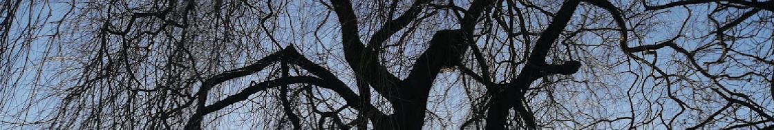
Cherry blossoms and tower blocks
After plunging into the countryside, we are once again in suburbia, with cherry trees in blossom silhouetted against dark skies (hopefully the skies will be sunny on our actual walk!) A walk down a ginnel, gennel, jitty or whatever you want to call a narrow alleyway brings you out in a playing field in the shadow of Stannington’s 1960s tower blocks. These three towers look a bit out of place in what’s essentially a village on the edge of the Peak District, but have become an iconic part of the landscape! As a long term resident of Crookes and Walkley, I’m used to looking at them from the opposite side of the valley – it’s quite strange to see them this close. Intriguingly nearby on my map, it says “remains of tower” – a church tower, or maybe something from the days when this was Robin Hood’s forest? Maybe we will find out next Saturday, but it was a bit soggy so I didn’t stop to investigate.
Popping out through a rather foreboding underpass which also seems like it doesn’t quite belong in the landscape, the 1960s housing estate continues, but on a much more human scale. Small houses with quirky individual gardens and communal washing lines perch on the edge of the hillside. This section of the walk is best seen this time of year though – the cherry blossom is gorgeous. Walking downhill, the view of the Rivelin Valley opens up with the former Bell Hag Inn appearing like a centuries-old tower block because of the way it’s built into the hillside.


Return to Rivelin
Emerging from the cherry trees, it starts to feel more like the countryside. There’s an old chapel and a quarry in a woodland. A steep cobbled path runs downhill past the chapel (now a house with a nosy cat looking out of the window). Thankfully this path is not slippery and I realised that it must be the path that the workers at the grinding wheels (small water-powered cutlery factories) must have taken too and from work every day. It’s difficult to imagine this beautiful place being a hive of industry. For everything you need to know about the Rivelin Valley, The Rivelin Valley Conservation Group’s excellent website – and the information posts and plaques dotted along the valley – really give a picture of what life here used to be like. https://rivelinvalley.org.uk/the_valley/
It was almost a surprise to descend to the road that crosses the river. I decided to take the path immediately on my left, taking me through Rivelin Glen, as I’d never followed this route before. But the main path following the river more closely might be the more sensible choice and it involved steep climbs up and down and some very muddy bits. Still, it was an adventure, and I came out at the ruins of Roscoe Mill This was when a lady in running gear shouted ‘Look! Look!’ at me and pointed towards the hillside. For a split second, I was worried that a terrible accident had happened, then I saw two deer running up the hillside. I could see them clearly, especially their white tails bobbing up and down through the trees. I think they were roe deer It was a magical moment and both me and the jogger looked on in amazement. She said that in over thirty years of coming to the Rivelin Valley, she’d never seen deer here before. And neither had I – but you never know what you might see. The Rivelin always has a kind of enchanted atmosphere about it for me, always leading to new discoveries.
Then it was a gentle walk, past Rivelin Valley’s very own throne sitting in the middle of the river and to the cafe. On Saturday 20th April, we’ll spend some time outside or inside the cafe, depending on the weather, to do some writing, and sharing what we have written or have been thinking about.


The final section of the path down to Malin Bridge tram stop again sadly doesn’t include the stepping stones downstream from the cafe – they have been partly washed away! This must have happened in the recent storms in autumn and winter. Further on from where we have walked, a whole section of the Rivelin trail has been washed away. I hope the stepping stones and path are restored soon, but it’s a stark reminder that the places we love are not there forever unless we respect them.
Passing the fire station on the opposite river bank, Mousehole Forge once produced anvils that were exported all over the world, most famously to the wild west of the USA back in the 19th century. Some of the mill buildings and the mill house are still standing, and amongst a ruined building, you can see th beams of a huge drop hammer. It’s a Scheduled Ancient Monument, but if you peer through the wrought iron gates too, a very barky dog appears!
As we emerge onto the road again at Malin Bridge, take a look at the carved stone wall outside Lidl, commemorating the Great Sheffield Flood.
Thanks for coming with me for a virtual walk! Please come with me in real life next week. Crossed fingers, the sun will shine, but whatever the weather, we’ll have a creative adventure – who knows where that will take us in our imaginations! Book your place on the Nature Writing Walk and Workshop here: https://www.eventbrite.co.uk/e/spring-nature-writing-workshop-and-walk-registration-844643470357?aff=oddtdtcreator

